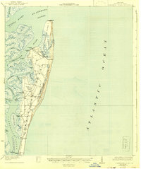
1930 Map of Cumberland Island
USGS Topo · Published 1942About this map
Cumberland Island and its smaller neighbor Little Cumberland Island dominate this coastal survey, revealing a landscape defined by water and maritime access. During this era, the island was sparsely settled but contained notable private estates and agricultural developments. The topography is marked by several historic riverfront landings, such as Plum Orchard Wharf and Dungeness Wharf, which served as the primary connection to the mainland via the Cumberland River and Cumberland Sound.
Find a feature on this map
38 named features on this map. Tap any name to fly to it.
Don’t see what you’re looking for? This feature index may not catch every label — zoom into the map to look around manually.
Map Details
Editions of this 1930 Cumberland Island Map
3 editions found
Other maps of this area

1918 · St Marys
USGS Topo · 1:62,500

1918 · Cumberland Island
USGS Topo · 1:62,500

1918 · Bladen
USGS Topo · 1:62,500

1918 · Kingsland
USGS Topo · 1:62,500

1919 · Fernandina
USGS Topo · 1:62,500

1919 · St Marys
USGS Topo · 1:62,500

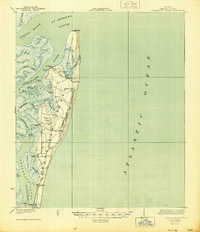
1930 · Cumberland Island
USGS Topo · 1:62,500

1939 · Bladen
USGS Topo · 1:62,500

1944 · Fernandina
USGS Topo · 1:62,500

1945 · Brunswick
USGS Topo · 1:62,500