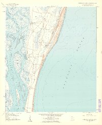
1958 Map of Cumberland Island South
USGS Topo · Published 1959About this map
Cumberland Island is depicted here in the late 1950s, showing a landscape defined by its maritime connections and large estate wharves. The map captures the island's interior ponds, such as McCall Pond and Johnson Pond, alongside tidal marshes and winding waterways like the Brickhill River and Crooked River. Private landings including Plum Orchard Wharf and Dungeness Wharf suggest a period of transition before the area's later federal protection, when these locations served as primary access points for the island's historic estates. On the mainland side, the Army Terminal at Kings Bay marks a significant military presence, contrasted by the quiet Cem and isolated settlements of the island. The Intracoastal Waterway threads through the sound, illustrating the importance of this sheltered coastal passage for mid-century navigation between the Georgia coast and the open Atlantic Ocean.
Find a feature on this map
21 named features on this map. Tap any name to fly to it.
Don’t see what you’re looking for? This feature index may not catch every label — zoom into the map to look around manually.
Map Details
Editions of this 1958 Cumberland Island South Map
Other maps of this area

1918 · St Marys
USGS Topo · 1:62,500

1918 · Cumberland Island
USGS Topo · 1:62,500

1918 · Kingsland
USGS Topo · 1:62,500

1919 · Fernandina
USGS Topo · 1:62,500

1919 · St Marys
USGS Topo · 1:62,500

1930 · Cumberland Island
USGS Topo · 1:62,500

1944 · Fernandina
USGS Topo · 1:62,500

1945 · Cumberland Island
USGS Topo · 1:62,500

1948 · Jacksonville
USGS Topo · 1:250,000

1957 · Jacksonville
USGS Topo · 1:250,000