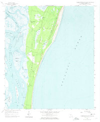
1958 Map of Cumberland Island South
USGS Topo · Published 1974About this map
Cumberland Island remains a landscape defined by its isolated coastal character and maritime infrastructure in the late 1950s. The western shoreline is deeply indented by the Brickhill River and Cumberland Sound, where specialized landings like Plum Orchard Wharf and Dungeness Wharf provide the primary access to the island's interior estates. The southern end of the sheet is dominated by the Kings Bay Army Terminal, signaling the strategic military importance of these deep-water channels and the Intracoastal Waterway.
Find a feature on this map
27 named features on this map. Tap any name to fly to it.
Don’t see what you’re looking for? This feature index may not catch every label — zoom into the map to look around manually.
Map Details
Editions of this 1958 Cumberland Island South Map
Other maps of this area

1918 · St Marys
USGS Topo · 1:62,500

1918 · Cumberland Island
USGS Topo · 1:62,500

1918 · Kingsland
USGS Topo · 1:62,500

1919 · Fernandina
USGS Topo · 1:62,500

1919 · St Marys
USGS Topo · 1:62,500

1930 · Cumberland Island
USGS Topo · 1:62,500

1944 · Fernandina
USGS Topo · 1:62,500

1945 · Cumberland Island
USGS Topo · 1:62,500

1948 · Jacksonville
USGS Topo · 1:250,000

1957 · Jacksonville
USGS Topo · 1:250,000