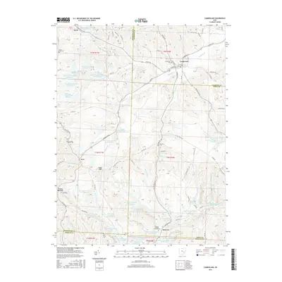
2016 Map of Cumberland
USGS Topo · Published 2016About this map
The village of Cumberland sits at a crossroads in the hills of southeast Ohio, where several rural townships meet. The landscape is defined by the legacy of resource extraction, shown by numerous water bodies like Central Ohio Coal Company Pond 9615-031 and several Ohio Power Company ponds, such as Ohio Power Company Pond Mum-48. These artificial lakes fill the hollows between ridges where the local economy was once tied to surface mining.
Find a feature on this map
146 named features on this map. Tap any name to fly to it.
Don’t see what you’re looking for? This feature index may not catch every label — zoom into the map to look around manually.
Map Details
Editions of this 2016 Cumberland Map
This is the sole edition of this map. No revisions or reprints were ever made.
Other maps of this area

1909 · Caldwell
USGS Topo · 1:62,500

1910 · Philo
USGS Topo · 1:62,500

1910 · Mc Connelsville
USGS Topo · 1:62,500

1911 · Cumberland
USGS Topo · 1:62,500

1912 · Caldwell
USGS Topo · 1:62,500

1949 · Clarksburg
USGS Topo · 1:250,000

1956 · Clarksburg
USGS Topo · 1:250,000

1961 · Clarksburg
USGS Topo · 1:250,000

1961 · Mc Connelsville
USGS Topo · 1:24,000
1961 · Caldwell South
USGS Topo · 1:24,000