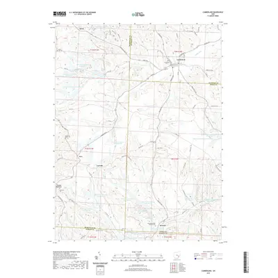
2019 Map of Cumberland
USGS Topo · Published 2019About this map
Cumberland sits at the intersection of Guernsey, Noble, and Muskingum counties, serving as a historic anchor for this rural Appalachian landscape. The terrain is defined by the extensive footprint of the Ohio Power Company, which maintained numerous water management sites such as Ohio Power Company Pond Nb-99 and Ohio Power Company Pond Mum-48 throughout the hills. Small agricultural and mining settlements like Coal Hill and Renrock are connected by a network of winding roads, including Big Muskie Dr and Coal Hill Rd.
Find a feature on this map
105 named features on this map. Tap any name to fly to it.
Don’t see what you’re looking for? This feature index may not catch every label — zoom into the map to look around manually.
Map Details
Editions of this 2019 Cumberland Map
This is the sole edition of this map. No revisions or reprints were ever made.
Other maps of this area

1909 · Caldwell
USGS Topo · 1:62,500

1910 · Philo
USGS Topo · 1:62,500

1910 · Mc Connelsville
USGS Topo · 1:62,500

1911 · Cumberland
USGS Topo · 1:62,500

1912 · Caldwell
USGS Topo · 1:62,500

1949 · Clarksburg
USGS Topo · 1:250,000

1956 · Clarksburg
USGS Topo · 1:250,000

1961 · Clarksburg
USGS Topo · 1:250,000

1961 · Mc Connelsville
USGS Topo · 1:24,000
1961 · Caldwell South
USGS Topo · 1:24,000