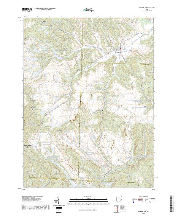
2023 Map of Cumberland
USGS Topo · Published 2023About this map
Cumberland sits at the junction of four counties — Guernsey, Noble, Muskingum, and Morgan — in a landscape heavily defined by industrial water management. The terrain is densely populated with artificial water bodies associated with the Ohio Power Company, including numerous reservoirs such as Ohio Power Company Pond Nb-102 and Ohio Power Company Pond Mum-90. These ponds, frequently numbered rather than named, underscore the region's history with large-scale land use and utility infrastructure.
Find a feature on this map
106 named features on this map. Tap any name to fly to it.
Don’t see what you’re looking for? This feature index may not catch every label — zoom into the map to look around manually.
Map Details
Editions of this 2023 Cumberland Map
This is the sole edition of this map. No revisions or reprints were ever made.
Other maps of this area

1909 · Caldwell
USGS Topo · 1:62,500

1910 · Philo
USGS Topo · 1:62,500

1910 · Mc Connelsville
USGS Topo · 1:62,500

1911 · Cumberland
USGS Topo · 1:62,500

1912 · Caldwell
USGS Topo · 1:62,500

1949 · Clarksburg
USGS Topo · 1:250,000

1956 · Clarksburg
USGS Topo · 1:250,000

1961 · Clarksburg
USGS Topo · 1:250,000

1961 · Mc Connelsville
USGS Topo · 1:24,000
1961 · Caldwell South
USGS Topo · 1:24,000