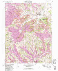
1994 Map of Cumberland
USGS Topo · Published 1998About this map
Cumberland sits at the convergence of rugged drainage systems and industrial landscape transformation in southeastern Ohio during the late 20th century. The topography is defined by the extensive presence of Reclaimed Strip Mines, which cover significant portions of the townships of Spencer, Rich Hill, and Brookfield. These purple-shaded areas indicate where the land has been re-contoured following extraction, creating a distinct visual contrast with the natural dendritic patterns of Buffalo Fork and Mays Fork.
Find a feature on this map
40 named features on this map. Tap any name to fly to it.
Don’t see what you’re looking for? This feature index may not catch every label — zoom into the map to look around manually.
Map Details
Editions of this 1994 Cumberland Map
This is the sole edition of this map. No revisions or reprints were ever made.
Other maps of this area

1909 · Caldwell
USGS Topo · 1:62,500

1910 · Philo
USGS Topo · 1:62,500

1910 · Mc Connelsville
USGS Topo · 1:62,500

1911 · Cumberland
USGS Topo · 1:62,500

1912 · Caldwell
USGS Topo · 1:62,500

1949 · Clarksburg
USGS Topo · 1:250,000

1956 · Clarksburg
USGS Topo · 1:250,000

1961 · Clarksburg
USGS Topo · 1:250,000

1961 · Mc Connelsville
USGS Topo · 1:24,000
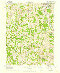
1961 · Caldwell South
USGS Topo · 1:24,000