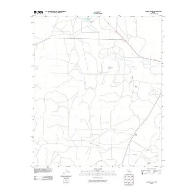
2010 Map of Cumbie Draw
USGS Topo · Published 2010About this map
Foster Ranch and the nearby Foster Cemetery anchor the southeastern corner of this West Texas landscape, where ranching and energy interests define the local economy. The terrain is characterized by a series of drainage systems, including the prominent Cumbie Draw, Cobb Draw, and James Hollow, which channel water toward Sterling Creek and the North Concho River. In the north, the W H Reed Dam impounds the W H Reed Reservoir, providing a vital water source for this arid region. Private aviation and resource extraction are evident through the McEntires Lazy V Ranch Airport and the expansive Durham Oil Field. The road network, including Hunt Rd and Foster Cemetary Rd, follows the natural contours of the land, connecting these remote ranching hubs and industrial sites across Sterling County.
Find a feature on this map
17 named features on this map. Tap any name to fly to it.
Don’t see what you’re looking for? This feature index may not catch every label — zoom into the map to look around manually.
Map Details
Editions of this 2010 Cumbie Draw Map
This is the sole edition of this map. No revisions or reprints were ever made.
Other maps of this area

1954 · San Angelo
USGS Topo · 1:250,000

1958 · San Angelo
USGS Topo · 1:250,000

1963 · Cumbie Draw
USGS Topo · 1:24,000

1963 · Glass Ranch
USGS Topo · 1:24,000

1963 · Cumbie Draw NE
USGS Topo · 1:24,000
1963 · Sand Bluff Draw
USGS Topo · 1:24,000

1965 · San Angelo
USGS Topo · 1:250,000

1972 · Sterling City
USGS Topo · 1:24,000
1972 · Sterling City NW
USGS Topo · 1:24,000

1972 · Dog Creek NW
USGS Topo · 1:24,000