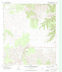
1972 Map of Sterling City NW
USGS Topo · Published 1974About this map
The West Texas landscape of Sterling County is defined by a network of ephemeral watercourses and early 1970s energy infrastructure in this quadrangle. The northern reaches are carved by North Gasconade Creek, where multiple points marked simply as Spring indicate the vital natural water sources in this semi-arid region. To the south, the terrain descends into the broad Mackenzie Draw and the more confined Cox Hollow, illustrating the drainage patterns that have historically dictated land use and ranching boundaries in the area.
Find a feature on this map
13 named features on this map. Tap any name to fly to it.
Don’t see what you’re looking for? This feature index may not catch every label — zoom into the map to look around manually.
Map Details
Editions of this 1972 Sterling City NW Map
2 editions found
Other maps of this area

1954 · Big Spring
USGS Topo · 1:250,000

1954 · San Angelo
USGS Topo · 1:250,000

1958 · San Angelo
USGS Topo · 1:250,000

1958 · Big Spring
USGS Topo · 1:250,000

1959 · McWhorter Mountain
USGS Topo · 1:24,000

1959 · Dead Indian Mountain
USGS Topo · 1:24,000

1963 · Cumbie Draw
USGS Topo · 1:24,000

1963 · Cumbie Draw NE
USGS Topo · 1:24,000

1963 · Buffalo Draw
USGS Topo · 1:24,000

1965 · San Angelo
USGS Topo · 1:250,000