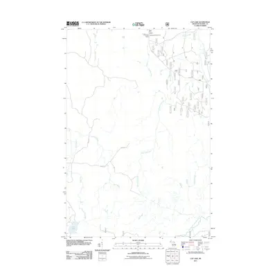
2011 Map of Cup Lake
USGS Topo · Published 2011About this map
Matchwood Lookout Tower stands as a focal point in this northern Michigan wilderness, overlooking a landscape defined by an intricate network of cold-water drainage systems. The area is heavily managed for forestry and recreation, as evidenced by the numerous numbered forest service routes like Fs 6936 and the presence of Matchwood Campground. The hydrology of this region is particularly complex, with Tenmile Creek, Wanagan Creek, and Sisson-Lilley Creek carving through the terrain to feed the Cisco Branch Ontonagon River in the south. In the southwest corner, the isolated Cup Lake is surrounded by the headwaters of Trout Brook, while names like Camp 6 Rd hint at the logging heritage that has shaped these woods for generations.
Find a feature on this map
46 named features on this map. Tap any name to fly to it.
Don’t see what you’re looking for? This feature index may not catch every label — zoom into the map to look around manually.
Map Details
Editions of this 2011 Cup Lake Map
This is the sole edition of this map. No revisions or reprints were ever made.
Other maps of this area

1952 · Thayer
USGS Topo · 1:62,500

1955 · Marenisco
USGS Topo · 1:62,500

1956 · Bergland
USGS Topo · 1:62,500

1956 · Matchwood
USGS Topo · 1:62,500

1958 · Iron River
USGS Topo · 1:250,000

1960 · Iron River
USGS Topo · 1:250,000

1961 · Iron River
USGS Topo · 1:250,000

1967 · Iron River
USGS Topo · 1:250,000

1979 · Ontonagon
USGS Topo · 1:100,000
1982 · Marshall Creek
USGS Topo · 1:24,000