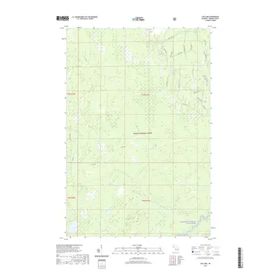
2019 Map of Cup Lake
USGS Topo · Published 2019About this map
The Ottawa National Forest dominates this landscape in Gogebic County, where a dense network of forest service roads and natural waterways defines the geography. In the southern reaches, the Middle Branch Ontonagon River winds through the protected Ontonagon Wild and Scenic River corridor. The terrain is a complex hydrologic system, evidenced by the convergence of Wolfgang Creek, Sisson-Lilley Cr, and Tenmile Cr. Local infrastructure is represented by primitive routes like Camp 6 Rd and Trout Creek Rd, which provide access to the interior timberlands. This 2019 survey illustrates the managed wilderness of Michigan's Upper Peninsula, centering on the namesake Cup Lake and the various tributaries, such as Trout Brook and Snuffbox Cr, that feed the larger river systems.
Find a feature on this map
35 named features on this map. Tap any name to fly to it.
Don’t see what you’re looking for? This feature index may not catch every label — zoom into the map to look around manually.
Map Details
Editions of this 2019 Cup Lake Map
This is the sole edition of this map. No revisions or reprints were ever made.
Other maps of this area

1952 · Thayer
USGS Topo · 1:62,500

1955 · Marenisco
USGS Topo · 1:62,500

1956 · Bergland
USGS Topo · 1:62,500

1956 · Matchwood
USGS Topo · 1:62,500

1958 · Iron River
USGS Topo · 1:250,000

1960 · Iron River
USGS Topo · 1:250,000

1961 · Iron River
USGS Topo · 1:250,000

1967 · Iron River
USGS Topo · 1:250,000

1979 · Ontonagon
USGS Topo · 1:100,000
1982 · Marshall Creek
USGS Topo · 1:24,000