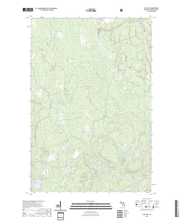
2023 Map of Cup Lake
USGS Topo · Published 2023About this map
Ottawa National Forest dominates this section of the western Upper Peninsula, characterized by a dense network of watercourses and forest service trails. The landscape is defined by the drainage systems of the Middle Branch Ontonagon River, which winds through the southeastern corner of the quadrangle. Numerous small streams including Tenmile Creek, Wanagan Creek, and Sisson-Lilley Creek carve through the wooded terrain, while Cup Lake provides a secluded focal point in the southwest. The area is heavily marked by remote infrastructure, primarily timber-management routes and recreation paths such as Camp 6 Rd and Trout Creek Rd, alongside an intricate system of numbered National Forest System Trails like Nfst-6939 Trl and Nfst-6937 Trl. This survey captures the specialized topography of a region dedicated to forest conservation and outdoor navigation.
Find a feature on this map
36 named features on this map. Tap any name to fly to it.
Don’t see what you’re looking for? This feature index may not catch every label — zoom into the map to look around manually.
Map Details
Editions of this 2023 Cup Lake Map
This is the sole edition of this map. No revisions or reprints were ever made.
Other maps of this area

1952 · Thayer
USGS Topo · 1:62,500

1955 · Marenisco
USGS Topo · 1:62,500

1956 · Bergland
USGS Topo · 1:62,500

1956 · Matchwood
USGS Topo · 1:62,500

1958 · Iron River
USGS Topo · 1:250,000

1960 · Iron River
USGS Topo · 1:250,000

1961 · Iron River
USGS Topo · 1:250,000

1967 · Iron River
USGS Topo · 1:250,000

1979 · Ontonagon
USGS Topo · 1:100,000
1982 · Marshall Creek
USGS Topo · 1:24,000