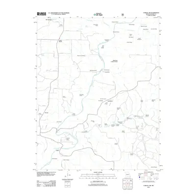
2012 Map of Cureall NW
USGS Topo · Published 2012About this map
North Fork River carves a deep path through this Missouri landscape, creating a complex network of ridges and hollows such as Creek Pond Ridge and Potato Cave Hollow. The settlement of Oakmound serves as a local focal point, home to the Oak Mound School and Oak Mound Cemetery. The geography is defined by its water sources, with numerous springs including Rainbow Spring, Althea Spring, and Cave Spring feeding the river system. For local historians, the map preserves the locations of several family and community burial grounds like Parson Cemetery and Woods Cemetery. The presence of the High Place Lookout Tower and Sunburst Ranch Airport indicates how modern fire observation and private aviation have integrated into this traditional Ozark terrain.
Find a feature on this map
91 named features on this map. Tap any name to fly to it.
Don’t see what you’re looking for? This feature index may not catch every label — zoom into the map to look around manually.
Map Details
Editions of this 2012 Cureall NW Map
This is the sole edition of this map. No revisions or reprints were ever made.
Other maps of this area

1934 · Gainesville
USGS Topo · 1:48,000

1937 · Buckhart
USGS Topo · 1:48,000

1939 · Topaz
USGS Topo · 1:62,500

1940 · Gainesville
USGS Topo · 1:62,500

1941 · Topaz
USGS Topo · 1:62,500

1943 · Buckhart
USGS Topo · 1:62,500

1944 · Cureall
USGS Topo · 1:62,500

1945 · Harrison
USGS Topo · 1:250,000

1945 · Buckhart
USGS Topo · 1:62,500

1946 · Cureall
USGS Topo · 1:62,500