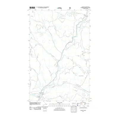
2011 Map of Curlew
USGS Topo · Published 2011About this map
The Kettle River defines this landscape in northern Ferry County, carving a narrow valley through the high peaks of the Colville National Forest. The settlement of Curlew serves as a focal point in the south, where the Curlew Bridge and Kettle River Bridge provide essential crossings for local transit. Further north, the town of Danville sits right at the international boundary, marked by the Danville Post Office.
Find a feature on this map
64 named features on this map. Tap any name to fly to it.
Don’t see what you’re looking for? This feature index may not catch every label — zoom into the map to look around manually.
Map Details
Editions of this 2011 Curlew Map
This is the sole edition of this map. No revisions or reprints were ever made.
Other maps of this area

1904 · Republic
USGS Topo · 1:125,000

1936 · Marcus
USGS Topo · 1:96,000

1942 · Marcus
USGS Topo · 1:125,000

1948 · Curlew
USGS Topo · 1:62,500

1948 · Togo Mountain
USGS Topo · 1:62,500

1951 · Togo Mountain
USGS Topo · 1:62,500

1951 · Curlew
USGS Topo · 1:62,500

1954 · Okanogan
USGS Topo · 1:250,000

1958 · Okanogan
USGS Topo · 1:250,000
1983 · Boundary Mtn
USGS Topo · 1:24,000