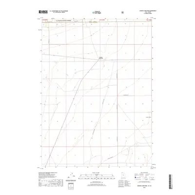
2020 Map of Curlew Junction
USGS Topo · Published 2020About this map
Sawtooth National Forest dominates the northern border of this high-desert landscape where the state lines of Idaho and Utah meet. Located in Curlew Valley, this area represents a vast open range defined by essential water sources like Pilot Spring and Duffu Cr. The intersection at Curlew Junction serves as a critical point for local transit, connecting specialized routes such as Black Pine Rd and Wildcat Mountain Rd. The map illustrates the 2020 transition between the forest's edge and the alluvial plains of the valley, capturing the essential infrastructure of forest development roads and county lines that manage this remote borderland.
Find a feature on this map
13 named features on this map. Tap any name to fly to it.
Don’t see what you’re looking for? This feature index may not catch every label — zoom into the map to look around manually.
Map Details
Editions of this 2020 Curlew Junction Map
This is the sole edition of this map. No revisions or reprints were ever made.
Other maps of this area

1954 · Pocatello
USGS Topo · 1:250,000

1954 · Brigham City
USGS Topo · 1:250,000

1958 · Pocatello
USGS Topo · 1:250,000

1958 · Brigham City
USGS Topo · 1:250,000

1959 · Strevell
USGS Topo · 1:62,500

1959 · Kelton Pass
USGS Topo · 1:62,500

1962 · Brigham City
USGS Topo · 1:250,000

1968 · Monument Peak NW
USGS Topo · 1:24,000

1968 · Monument Peak SW
USGS Topo · 1:24,000

1973 · Black Pine
USGS Topo · 1:24,000