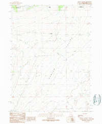
1990 Map of Curlew Junction
USGS Topo · Published 1990About this map
Curlew Valley defines the arid landscape of this border region where Box Elder County, Utah, meets Cassia County, Idaho. The map captures a high-desert environment shaped by historical passage and modern water management, notably featuring the trace of the Emigrant Trail as it cuts across the terrain. At Curlew Junction, the intersection of transport and topography is clear, with infrastructure like an aqueduct and an Abandoned Ditch illustrating the ongoing effort to manage water in this basin. To the north, the boundary of the Sawtooth National Forest introduces more varied elevation, while isolated water sources like Pilot Spring remain critical landmarks in an otherwise sparse landscape. The presence of several Gravel Pit sites suggests local industrial activity within the valley’s open expanse.
Find a feature on this map
11 named features on this map. Tap any name to fly to it.
Don’t see what you’re looking for? This feature index may not catch every label — zoom into the map to look around manually.
Map Details
Editions of this 1990 Curlew Junction Map
This is the sole edition of this map. No revisions or reprints were ever made.
Other maps of this area

1954 · Pocatello
USGS Topo · 1:250,000

1954 · Brigham City
USGS Topo · 1:250,000

1958 · Pocatello
USGS Topo · 1:250,000

1958 · Brigham City
USGS Topo · 1:250,000

1959 · Strevell
USGS Topo · 1:62,500

1959 · Kelton Pass
USGS Topo · 1:62,500

1962 · Brigham City
USGS Topo · 1:250,000

1968 · Monument Peak NW
USGS Topo · 1:24,000

1968 · Monument Peak SW
USGS Topo · 1:24,000

1973 · Black Pine
USGS Topo · 1:24,000