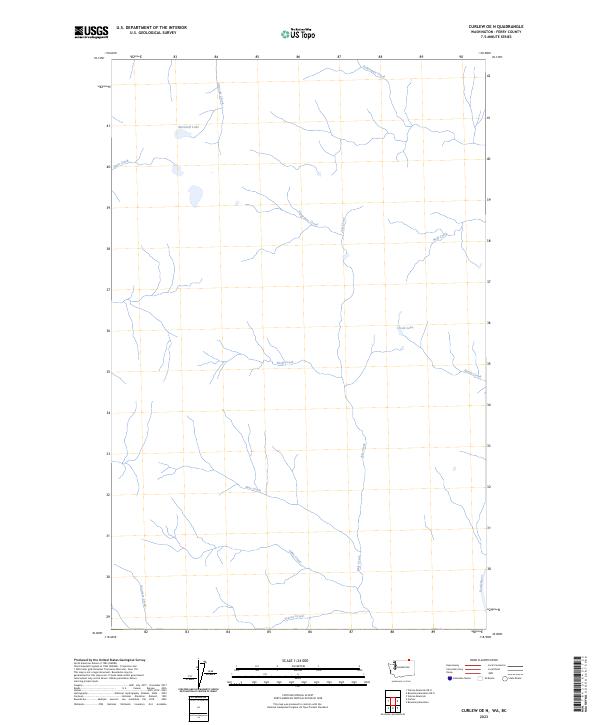
2023 Map of Curlew OE N
USGS Topo · Published 2023About this map
The Kettle River corridor in northern Ferry County defines this remote corner of Washington, where water drainage patterns dictate the shape of the land. Small water bodies like Marshall Lake and Crook Lake are fed by an intricate network of seasonal and perennial streams, including Glenside Creek and Twin Creek in the northwest. The terrain is deeply inscribed by these waterways, with July Creek running nearly the entire north-south length of the area, joined by tributaries such as Snowshoe Creek and Skeff Creek.
Find a feature on this map
15 named features on this map. Tap any name to fly to it.
Don’t see what you’re looking for? This feature index may not catch every label — zoom into the map to look around manually.
Map Details
Editions of this 2023 Curlew OE N Map
This is the sole edition of this map. No revisions or reprints were ever made.
Other maps of this area

1904 · Republic
USGS Topo · 1:125,000

1936 · Marcus
USGS Topo · 1:96,000

1942 · Marcus
USGS Topo · 1:125,000

1948 · Curlew
USGS Topo · 1:62,500

1948 · Togo Mountain
USGS Topo · 1:62,500

1951 · Togo Mountain
USGS Topo · 1:62,500

1951 · Curlew
USGS Topo · 1:62,500

1954 · Okanogan
USGS Topo · 1:250,000

1958 · Okanogan
USGS Topo · 1:250,000
1983 · Boundary Mtn
USGS Topo · 1:24,000