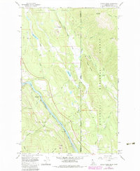
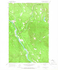
1965 Map of Curley Creek
USGS Topo · Published 1984About this map
Kaniksu National Forest and Kootenai National Forest dominate this borderland where Boundary County, Idaho, meets Lincoln County, Montana. The topography is defined by the significant corridor of the Kootenai River, which is paralleled by the tracks of the Burlington Northern railroad. The map reveals a landscape managed for both extraction and conservation, featuring the Homestake Mine and various jeep trails that pierce the dense woodlands. Higher elevations are marked by distinctive peaks such as Murphy Mountain and Cross Mountain, while the lowlands are punctuated by water bodies like Bonner Lake and Herman Lake. Local social foundations are visible through the location of the Central Sch, and old transportation routes are represented by the Leonia (Paxon) Trail, offering a detailed look at the infrastructure of the northern Idaho panhandle during the mid-1960s.
Find a feature on this map
23 named features on this map. Tap any name to fly to it.
Don’t see what you’re looking for? This feature index may not catch every label — zoom into the map to look around manually.
Map Details
Editions of this 1965 Curley Creek Map
Other maps of this area

1911 · Priest Lake
USGS Topo · 1:250,000

1913 · Priest Lake
USGS Topo · 1:250,000

1957 · Kalispell
USGS Topo · 1:250,000

1958 · Sandpoint
USGS Topo · 1:250,000

1960 · Kalispell
USGS Topo · 1:250,000

1961 · Kalispell
USGS Topo · 1:250,000

1963 · Sandpoint
USGS Topo · 1:250,000

1963 · Mount Baldy
USGS Topo · 1:24,000
1963 · Newton Mountain
USGS Topo · 1:24,000
1963 · Kilbrennan Lake
USGS Topo · 1:24,000