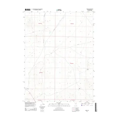
2014 Map of Currie
USGS Topo · Published 2014About this map
Currie serves as the primary focal point of this Nevada landscape, situated within a topography defined by the Currie Hills and the winding course of Currie Canyon. The settlement's connection to the surrounding basin is traced through a network of local thoroughfares, including Goshute Valley Rd and Mizpah Rd, which traverse the open terrain. Drainage patterns are established by intermittent watercourses like Phalen Cr and Nelson Cr, which cut through the various sections of the public land survey system. This 2014 representation details the intersection of modern infrastructure, such as Cr-785, with the established geographic landmarks of Elko County, offering a clear view of the area's rural transit corridors and natural drainage basins.
Find a feature on this map
14 named features on this map. Tap any name to fly to it.
Don’t see what you’re looking for? This feature index may not catch every label — zoom into the map to look around manually.
Map Details
Editions of this 2014 Currie Map
This is the sole edition of this map. No revisions or reprints were ever made.
Other maps of this area

1955 · Elko
USGS Topo · 1:250,000

1958 · Elko
USGS Topo · 1:250,000

1962 · Elko
USGS Topo · 1:250,000

1965 · Elko
USGS Topo · 1:250,000

1982 · Currie
USGS Topo · 1:24,000

1982 · Sharp Peak
USGS Topo · 1:24,000
1982 · Goshute Lake NE
USGS Topo · 1:24,000

1982 · Mizpah
USGS Topo · 1:24,000
1982 · Mizpah Point
USGS Topo · 1:24,000
1982 · Goshute Lake North
USGS Topo · 1:24,000