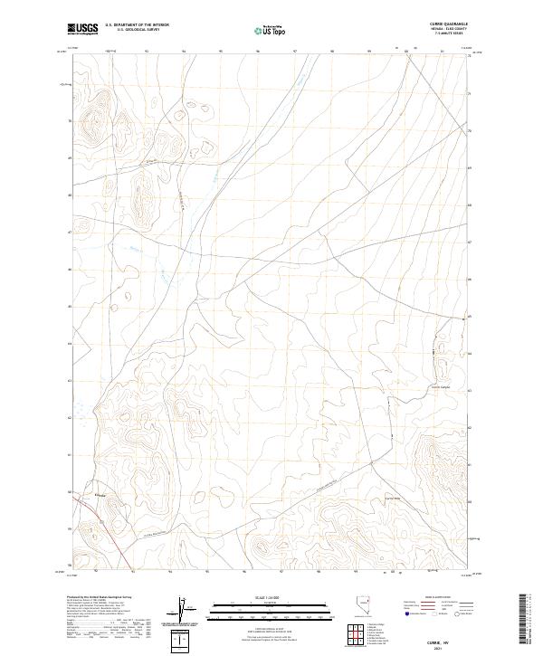
2021 Map of Currie
USGS Topo · Published 2021About this map
The small settlement of Currie serves as a lone anchor point in this high-altitude landscape of eastern Nevada. Situated along a network of remote routes like the Victoria Mine Back Rd and Goshute Valley Rd, this region reflects the sparse, utilitarian settlement patterns of the Elko County backcountry. The terrain is defined by the prominent Currie Hills and the seasonal drainages of Nelson Cr and Phalen Cr, which flow through the basin toward the Goshute Valley.
Find a feature on this map
14 named features on this map. Tap any name to fly to it.
Don’t see what you’re looking for? This feature index may not catch every label — zoom into the map to look around manually.
Map Details
Editions of this 2021 Currie Map
This is the sole edition of this map. No revisions or reprints were ever made.
Other maps of this area

1955 · Elko
USGS Topo · 1:250,000

1958 · Elko
USGS Topo · 1:250,000

1962 · Elko
USGS Topo · 1:250,000

1965 · Elko
USGS Topo · 1:250,000

1982 · Currie
USGS Topo · 1:24,000

1982 · Sharp Peak
USGS Topo · 1:24,000
1982 · Goshute Lake NE
USGS Topo · 1:24,000

1982 · Mizpah
USGS Topo · 1:24,000
1982 · Mizpah Point
USGS Topo · 1:24,000
1982 · Goshute Lake North
USGS Topo · 1:24,000