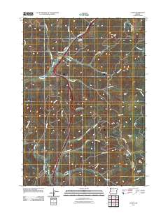
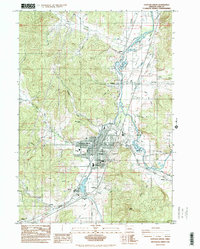
2011 Map of Curtin
USGS Topo · Published 2011About this map
Pass Creek carves a central corridor through this portion of Douglas County, dictating the placement of early settlements and transportation routes. The small communities of Comstock, Curtin, and Anlauf are situated along this waterway, reflecting a settlement pattern tied to the low-lying valley floor between prominent peaks. Genealogists and local historians can pinpoint the Comstock Cemetery and the Curtin Post Office, both of which serve as anchors for the area's social history. The surrounding landscape is defined by a series of significant elevations, including Wards Butte, Redford Butte, and Spike Buck Butte. Numerous tributaries such as Pheasant Creek, Ward Creek, and Lees Creek feed into the main drainage system, illustrating a complex hydraulic network. The presence of Lake Diane near Curtin adds a distinct water feature to an otherwise stream-dominated topography, while various Bureau of Land Management roads indicate the intersection of public land management and local infrastructure.
Find a feature on this map
42 named features on this map. Tap any name to fly to it.
Don’t see what you’re looking for? This feature index may not catch every label — zoom into the map to look around manually.
Map Details
Editions of this 2011 Curtin Map
This is the sole edition of this map. No revisions or reprints were ever made.
Other maps of this area
1921 · Cottage Grove
USGS Topo · 1:62,500
1942 · Crow
USGS Topo · 1:62,500
1945 · Crow
USGS Topo · 1:62,500
1954 · Drain
USGS Topo · 1:62,500
1954 · Anlauf
USGS Topo · 1:62,500
1957 · Cottage Grove
USGS Topo · 1:62,500

1958 · Roseburg
USGS Topo · 1:250,000

1959 · Roseburg
USGS Topo · 1:250,000
1979 · Cottage Grove
USGS Topo · 1:100,000
1984 · Cottage Grove
USGS Topo · 1:24,000