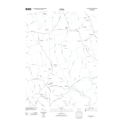
2013 Map of Curtisville
USGS Topo · Published 2013About this map
Curtisville and Millerstown anchor the southern reaches of this Butler County landscape, where the headwaters of Bull Cr and Little Deer Cr carve a rolling topography of small valleys. The map illustrates a dense network of cross-country roads connecting small historical settlements such as Lardintown, Ekastown, and the curiously named Red Hot. The northern section is dominated by the corridor near Lernerville and Sarversville, where Little Buffalo Cr flows toward the county line. This 2013 topographic survey captures the area’s character as a transition between established small-town centers and the surrounding hillsides. Noteworthy landmarks like the Culmerville Airport and Saxon Golf Course appear alongside traditional place names like Coal Hollow and Mineral Spring, offering a detailed view of the region's modern layout while preserving the nomenclature of its early rural development.
Find a feature on this map
122 named features on this map. Tap any name to fly to it.
Don’t see what you’re looking for? This feature index may not catch every label — zoom into the map to look around manually.
Map Details
Editions of this 2013 Curtisville Map
This is the sole edition of this map. No revisions or reprints were ever made.
Other maps of this area

1900 · Kittanning
USGS Topo · 1:62,500

1902 · Kittanning
USGS Topo · 1:62,500

1907 · Freeport
USGS Topo · 1:62,500

1908 · New Kensington
USGS Topo · 1:62,500

1909 · Freeport
USGS Topo · 1:62,500

1909 · Butler
USGS Topo · 1:62,500

1910 · New Kensington
USGS Topo · 1:62,500

1911 · Butler
USGS Topo · 1:62,500

1950 · Valencia
USGS Topo · 1:24,000

1953 · Pittsburgh
USGS Topo · 1:250,000
Featured Places
- Clinton Township, PA
- Curtisville, West Deer Township
- Winfield Township, PA
- Blanchard, West Deer Township
- Cunningham, PA