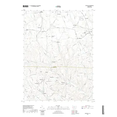
2019 Map of Curtisville
USGS Topo · Published 2019About this map
Saxonburg stands at the northern edge of this landscape, anchoring a network of small crossroad settlements and hamlets spread across the Butler and Allegheny County line. The terrain is defined by the winding paths of Bull Creek and Little Deer Creek, which flow south toward the industrial valleys beyond this quadrangle. This 2019 survey captures a rural and suburbanizing area where legacy land use is marked by a high density of burial grounds, such as the Oak Grove Cem and Pleasant Unity Cem. Aviation history is present at the Culmerville Airport, while the clustering of namesake communities like Lardintown, Ekastown, and Sarversville reflects the deep-rooted family settlement patterns of these townships. Transport is centered on the Saxonburg Boulevard corridor, linking the residential pockets of Curtisville and Benjamin to the older village centers.
Find a feature on this map
134 named features on this map. Tap any name to fly to it.
Don’t see what you’re looking for? This feature index may not catch every label — zoom into the map to look around manually.
Map Details
Editions of this 2019 Curtisville Map
This is the sole edition of this map. No revisions or reprints were ever made.
Other maps of this area

1900 · Kittanning
USGS Topo · 1:62,500

1902 · Kittanning
USGS Topo · 1:62,500

1907 · Freeport
USGS Topo · 1:62,500

1908 · New Kensington
USGS Topo · 1:62,500

1909 · Freeport
USGS Topo · 1:62,500

1909 · Butler
USGS Topo · 1:62,500

1910 · New Kensington
USGS Topo · 1:62,500

1911 · Butler
USGS Topo · 1:62,500

1950 · Valencia
USGS Topo · 1:24,000

1953 · Pittsburgh
USGS Topo · 1:250,000
Featured Places
- Clinton Township, PA
- Curtisville, West Deer Township
- Winfield Township, PA
- Blanchard, West Deer Township
- Cunningham, PA