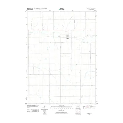
2010 Map of Cushing
USGS Topo · Published 2010About this map
Cushing serves as the central hub of this agricultural landscape in Woodbury County, defined by a strictly organized section-line road network. The community is anchored by the Cushing Post Office and its nearby Cushing Cemetery, reflecting the enduring settlement patterns of the Iowa prairie. To the south, Rock Cemetery stands as another localized point of interest for genealogists and local historians. The terrain is carved by a series of south-flowing waterways, including Bacon Creek, Coon Creek, and the West Fork Battle Creek, which break the geometric precision of the township roads. These drainage systems, such as Moorhead Creek and Aldrich Creek, dictate the subtle shifts in the land where the grid of avenues like Taylor Ave and Union Ave meets the natural contours of the watershed.
Find a feature on this map
27 named features on this map. Tap any name to fly to it.
Don’t see what you’re looking for? This feature index may not catch every label — zoom into the map to look around manually.
Map Details
Editions of this 2010 Cushing Map
This is the sole edition of this map. No revisions or reprints were ever made.
Other maps of this area

1954 · Fort Dodge
USGS Topo · 1:250,000

1957 · Fort Dodge
USGS Topo · 1:250,000

1958 · Fort Dodge
USGS Topo · 1:250,000

1967 · Holstein
USGS Topo · 1:24,000

1967 · Battle Creek
USGS Topo · 1:24,000

1969 · Holstein SW
USGS Topo · 1:24,000

1969 · Pierson
USGS Topo · 1:24,000

1969 · Correctionville
USGS Topo · 1:24,000

1969 · Cushing
USGS Topo · 1:24,000

1969 · Quimby SE
USGS Topo · 1:24,000