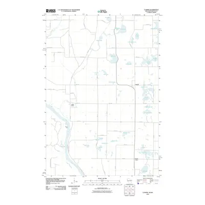
2010 Map of Cushing
USGS Topo · Published 2010About this map
The Saint Croix River defines the western edge of this landscape, its banks protected by the wooded expanse of Wild River State Park. This riverine corridor is historically significant as the site of Nevers Dam, once a critical point for log driving on the river. Moving inland, the topography is densely pocketed with glacial water bodies, from larger basins like Manitou Lake and Big Lake to smaller wetlands including Bog Lake and Rice Lake. Small crossroads settlements like Cushing, Wolf Creek, and Eureka Center anchor the rural road network, which follows a rigid grid of numbered avenues and streets that contrast with the winding course of River Rd and the recreational Snowmobile Trl cutting through the northern woods.
Find a feature on this map
61 named features on this map. Tap any name to fly to it.
Don’t see what you’re looking for? This feature index may not catch every label — zoom into the map to look around manually.
Map Details
Editions of this 2010 Cushing Map
This is the sole edition of this map. No revisions or reprints were ever made.
Other maps of this area

1900 · St Croix Dalles
USGS Topo · 1:62,500

1901 · St Croix Dalles
USGS Topo · 1:62,500

1950 · Rush City
USGS Topo · 1:48,000

1951 · Milltown
USGS Topo · 1:48,000

1953 · Stillwater
USGS Topo · 1:250,000

1955 · St. Croix Dalles
USGS Topo · 1:62,500

1955 · Rush City
USGS Topo · 1:62,500

1955 · Milltown
USGS Topo · 1:62,500

1955 · Forest Lake
USGS Topo · 1:62,500

1955 · Stillwater
USGS Topo · 1:250,000