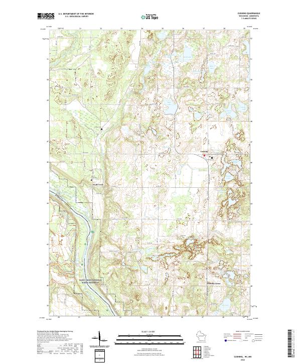
2022 Map of Cushing
USGS Topo · Published 2022About this map
Saint Croix National Scenic Riverway dominates the western edge of this Polk County landscape, marking the state boundary between Wisconsin and Minnesota along the Saint Croix Wild and Scenic River. The terrain is defined by a dense concentration of glacial water bodies, ranging from Big Lake in the south to Wolf Lake and Orr Lake in the north. The small settlements of Cushing, Wolf Creek, and Eureka Center serve as local hubs, connected by a network of rural roads like River Rd and Co Rd G. For those tracing local heritage, the map identifies several key burial sites including Pioneer Cem, Wolf Creek Cem, and Cushing Cem. A series of modern footpaths, such as Trillium Trl, Sunrise Trl, and Old Logging Trl, wind through the wooded areas near the river valley, following older routes through the Wolf Creek Valley.
Find a feature on this map
79 named features on this map. Tap any name to fly to it.
Don’t see what you’re looking for? This feature index may not catch every label — zoom into the map to look around manually.
Map Details
Editions of this 2022 Cushing Map
This is the sole edition of this map. No revisions or reprints were ever made.
Other maps of this area

1900 · St Croix Dalles
USGS Topo · 1:62,500

1901 · St Croix Dalles
USGS Topo · 1:62,500

1950 · Rush City
USGS Topo · 1:48,000

1951 · Milltown
USGS Topo · 1:48,000

1953 · Stillwater
USGS Topo · 1:250,000

1955 · St. Croix Dalles
USGS Topo · 1:62,500

1955 · Rush City
USGS Topo · 1:62,500

1955 · Milltown
USGS Topo · 1:62,500

1955 · Forest Lake
USGS Topo · 1:62,500

1955 · Stillwater
USGS Topo · 1:250,000