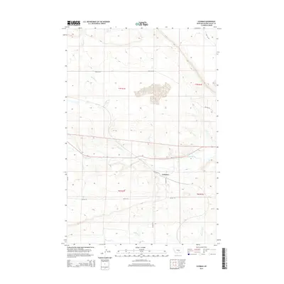
2014 Map of Cushman
USGS Topo · Published 2014About this map
Cushman sits along the southern bank of the Musselshell River in central Montana, serving as a focal point for local transportation and agricultural movement. The settlement is connected by W Cushman Rd and lies just south of the primary east-west corridor of Us-12. The surrounding landscape is defined by the drainage patterns of Ninemile Cr and Big Coulee Cr, which carve through the plains. The presence of Ninemile Spring in the northern reaches of the quadrangle indicates the importance of reliable water sources in this semi-arid region. Historic routes like Buffalo Trl hint at older transit paths across the open range, while a grid of local connectors like Nine Mile Rd and E Red Hill Rd supports the modern rural economy within the t7n r21e and t6n r21e township blocks.
Find a feature on this map
16 named features on this map. Tap any name to fly to it.
Don’t see what you’re looking for? This feature index may not catch every label — zoom into the map to look around manually.
Map Details
Editions of this 2014 Cushman Map
This is the sole edition of this map. No revisions or reprints were ever made.
Other maps of this area

1889 · Big Snowy Mountain
USGS Topo · 1:250,000

1893 · Big Snowy Mountain
USGS Topo · 1:250,000

1954 · Roundup
USGS Topo · 1:250,000

1958 · Roundup
USGS Topo · 1:250,000

1979 · Roundup
USGS Topo · 1:100,000

1979 · Lavina NW
USGS Topo · 1:24,000

1979 · Lavina
USGS Topo · 1:24,000

1979 · Belmont
USGS Topo · 1:24,000
1985 · Mount Sinai
USGS Topo · 1:24,000
1985 · Eagle Point
USGS Topo · 1:24,000