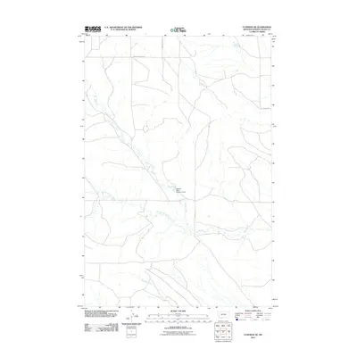
2011 Map of Cushman NE
USGS Topo · Published 2011About this map
Currant Creek winds through this section of Golden Valley County, Montana, providing a focal point for a landscape defined by its water drainage patterns and rural road network. The presence of the George Rath Number 2 Dam indicates small-scale water management and ranching infrastructure typical of this high-plains region. These features, along with Merrills Springs Creek and Fivemile Creek, suggest a terrain shaped by seasonal water flow and long-established land use. The sparse road network, including Womans Pocket Rd and E Red Hill Rd, connects the distant points of this expansive area. This 2011 survey by the U.S. Geological Survey documents the topographical layout of the region, emphasizing the importance of even minor waterways and local names like George Rath in a largely unsettled landscape.
Find a feature on this map
8 named features on this map. Tap any name to fly to it.
Don’t see what you’re looking for? This feature index may not catch every label — zoom into the map to look around manually.
Map Details
Editions of this 2011 Cushman NE Map
This is the sole edition of this map. No revisions or reprints were ever made.
Other maps of this area

1889 · Big Snowy Mountain
USGS Topo · 1:250,000

1893 · Big Snowy Mountain
USGS Topo · 1:250,000

1954 · Roundup
USGS Topo · 1:250,000

1958 · Roundup
USGS Topo · 1:250,000

1979 · Roundup
USGS Topo · 1:100,000

1979 · Lavina NW
USGS Topo · 1:24,000

1979 · Lavina
USGS Topo · 1:24,000
1986 · Ryegate East
USGS Topo · 1:24,000

1986 · Emory School
USGS Topo · 1:24,000

1986 · Cushman NW
USGS Topo · 1:24,000