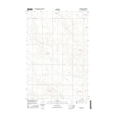
2017 Map of Cushman NE
USGS Topo · Published 2017About this map
Currant Cr and its tributaries carve through the heart of this Golden Valley County landscape, illustrating a drainage system that defines the local topography. This 2017 survey shows a region primarily organized by the Public Land Survey System, with township and range lines such as t8n r21e and t9n r21e providing the primary structure for land ownership and movement. The presence of routes like Womans Pocket Rd and E Red Hill Rd indicates a network of rural access points connecting remote homesteads or grazing lands to the larger region. Minor watercourses including Merrills Springs Cr and Fivemile Cr further delineate the terrain, while the distinctive Twin Coulee at the northeastern edge suggests the specific erosional features characteristic of this Montana high country.
Find a feature on this map
13 named features on this map. Tap any name to fly to it.
Don’t see what you’re looking for? This feature index may not catch every label — zoom into the map to look around manually.
Map Details
Editions of this 2017 Cushman NE Map
This is the sole edition of this map. No revisions or reprints were ever made.
Other maps of this area

1889 · Big Snowy Mountain
USGS Topo · 1:250,000

1893 · Big Snowy Mountain
USGS Topo · 1:250,000

1954 · Roundup
USGS Topo · 1:250,000

1958 · Roundup
USGS Topo · 1:250,000

1979 · Roundup
USGS Topo · 1:100,000

1979 · Lavina NW
USGS Topo · 1:24,000

1979 · Lavina
USGS Topo · 1:24,000
1986 · Ryegate East
USGS Topo · 1:24,000

1986 · Emory School
USGS Topo · 1:24,000

1986 · Cushman NW
USGS Topo · 1:24,000