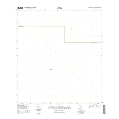
2015 Map of Custard Apple Hammock
USGS Topo · Published 2015About this map
Custard Apple Hammock defines this section of the Florida Everglades, serving as a localized high point within the broader aquatic landscape. This 2015 survey reveals the minimal impact of human infrastructure in this specific reach of the wetlands, where the primary geographical feature is the Shark River Slough. The slough acts as a vital conduit for freshwater flow, moving slowly across the flat terrain. The map also delineates the jurisdictional boundary between Broward Co and Miami-Dade Co, illustrating how these major South Florida counties share this protected wilderness area. For those studying the hydrology and natural topography of the Glades, the spatial relationship between the hammock and the surrounding slough provides an essential look at the region’s undisturbed ecosystem.
Find a feature on this map
3 named features on this map. Tap any name to fly to it.
Don’t see what you’re looking for? This feature index may not catch every label — zoom into the map to look around manually.
Map Details
Editions of this 2015 Custard Apple Hammock Map
This is the sole edition of this map. No revisions or reprints were ever made.
Other maps of this area

1956 · Miami
USGS Topo · 1:250,000

1956 · West Palm Beach
USGS Topo · 1:250,000

1957 · West Palm Beach
USGS Topo · 1:250,000

1958 · West Palm Beach
USGS Topo · 1:250,000

1958 · Miami
USGS Topo · 1:250,000

1973 · Fortymile Bend
USGS Topo · 1:24,000

1973 · Custard Apple Hammock
USGS Topo · 1:24,000

1973 · West Of Pennsuco
USGS Topo · 1:24,000

1973 · Everglades 4 SE
USGS Topo · 1:24,000

1973 · Long Island
USGS Topo · 1:24,000