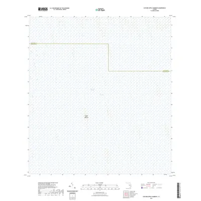
2021 Map of Custard Apple Hammock
USGS Topo · Published 2021About this map
The Everglades landscape dominates this 2021 survey, illustrating a vast expanse of wetland ecology within the southern reach of the peninsula. The map centers on the Custard Apple Hammock, a distinct hardwood rise that provides a rare point of elevation and terrestrial vegetation within the surrounding marsh. This area is defined by the slow movement of the Shark River Slough, a primary drainage artery that facilitates the southward flow of water through the glades. Positioned along the boundary of Broward and Miami-Dade counties, the map captures a portion of the wilderness preserved for conservation, showing no modern roads or permanent human settlements. The presence of the namesake hammock suggests the importance of these ecological islands for local wildlife and the region's natural history prior to modern drainage efforts.
Find a feature on this map
4 named features on this map. Tap any name to fly to it.
Don’t see what you’re looking for? This feature index may not catch every label — zoom into the map to look around manually.
Map Details
Editions of this 2021 Custard Apple Hammock Map
This is the sole edition of this map. No revisions or reprints were ever made.
Other maps of this area

1956 · Miami
USGS Topo · 1:250,000

1956 · West Palm Beach
USGS Topo · 1:250,000

1957 · West Palm Beach
USGS Topo · 1:250,000

1958 · West Palm Beach
USGS Topo · 1:250,000

1958 · Miami
USGS Topo · 1:250,000

1973 · Fortymile Bend
USGS Topo · 1:24,000

1973 · Custard Apple Hammock
USGS Topo · 1:24,000

1973 · West Of Pennsuco
USGS Topo · 1:24,000

1973 · Everglades 4 SE
USGS Topo · 1:24,000

1973 · Long Island
USGS Topo · 1:24,000