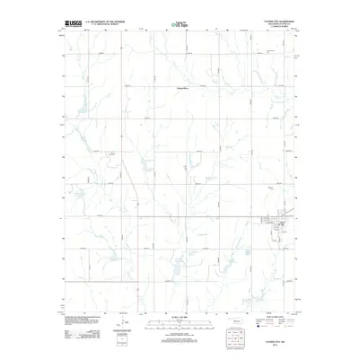
2012 Map of Custer City
USGS Topo · Published 2012About this map
Custer City sits at the junction of the central Oklahoma grid in this early 21st-century survey, its streets including Main St and W Broadway defining the local hub. The surrounding landscape in Custer County is a meticulously managed watershed, evidenced by an extensive network of flood control structures such as Beaver Cr Site 1 Reservoir and Haskett Reservoir. These water management features follow the winding paths of Beaver Cr and Horse Cr, which drain the agricultural uplands. Genealogy researchers will find significant local landmarks across the township, including the Independence Cem near the settlement of Independence and the Masonic Cem just north of the city limits. The map reveals the rigid section-line road system, from E0880 Rd to E0950 Rd, which has dictated the area's development since early settlement.
Find a feature on this map
42 named features on this map. Tap any name to fly to it.
Don’t see what you’re looking for? This feature index may not catch every label — zoom into the map to look around manually.
Map Details
Editions of this 2012 Custer City Map
This is the sole edition of this map. No revisions or reprints were ever made.
Other maps of this area

1955 · Clinton
USGS Topo · 1:250,000

1957 · Clinton
USGS Topo · 1:250,000

1957 · Butler
USGS Topo · 1:62,500

1957 · Clinton
USGS Topo · 1:62,500

1962 · Putnam
USGS Topo · 1:62,500

1962 · Aledo
USGS Topo · 1:62,500

1976 · Clinton SE
USGS Topo · 1:24,000

1976 · Butler NE
USGS Topo · 1:24,000

1976 · Clinton SW
USGS Topo · 1:24,000

1976 · Clinton NW
USGS Topo · 1:24,000