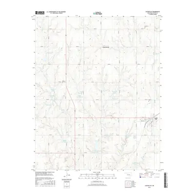
2016 Map of Custer City
USGS Topo · Published 2016About this map
Custer City anchors the southeast corner of this Oklahoma landscape, where a grid of local roads and streets like Broadway St and Main St delineate the town's footprint. The surrounding territory is defined by an extensive water management system along Beaver Creek and Horse Creek, featuring numerous flood control structures such as Beaver Creek Site 7 Reservoir and Beaver Cr Site 8 Reservoir. These reservoirs, along with private sites like Haskett Reservoir and Berrong Reservoir, highlight the agricultural necessity of water storage in Custer County.
Find a feature on this map
44 named features on this map. Tap any name to fly to it.
Don’t see what you’re looking for? This feature index may not catch every label — zoom into the map to look around manually.
Map Details
Editions of this 2016 Custer City Map
This is the sole edition of this map. No revisions or reprints were ever made.
Other maps of this area

1955 · Clinton
USGS Topo · 1:250,000

1957 · Clinton
USGS Topo · 1:250,000

1957 · Butler
USGS Topo · 1:62,500

1957 · Clinton
USGS Topo · 1:62,500

1962 · Putnam
USGS Topo · 1:62,500

1962 · Aledo
USGS Topo · 1:62,500

1976 · Clinton SE
USGS Topo · 1:24,000

1976 · Butler NE
USGS Topo · 1:24,000

1976 · Clinton SW
USGS Topo · 1:24,000

1976 · Clinton NW
USGS Topo · 1:24,000