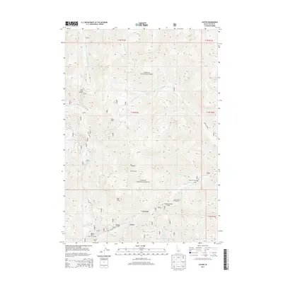
2013 Map of Custer
USGS Topo · Published 2013About this map
Custer remains the focal point of this high-elevation terrain within the Challis National Forest, positioned at the confluence where Yankee Fork meets Slaughterhouse Gulch. The landscape is defined by the legacy of industrial mining and remote mountain transit, most notably represented by the massive Yankee Fork Dredge located south of the settlement. Steep drainages like Puzzler Gulch and Swift Gulch cut through the peaks of Bald Mtn and Mt Greylock, illustrating the difficult geography of the Salmon River Mountains. Transportation through this backcountry relies on established routes such as Yankee Fork Rd and Loon Creek Rd, which provide access to high points like Loon Creek Summit. The presence of the Greylock Campground and Cutter Number 1 Campground indicates the modern transition of this once-booming mining district into a recreational and conservation-focused area.
Find a feature on this map
34 named features on this map. Tap any name to fly to it.
Don’t see what you’re looking for? This feature index may not catch every label — zoom into the map to look around manually.
Map Details
Editions of this 2013 Custer Map
This is the sole edition of this map. No revisions or reprints were ever made.
Other maps of this area

1919 · Custer
USGS Topo · 1:125,000

1922 · Custer
USGS Topo · 1:125,000

1930 · Casto
USGS Topo · 1:125,000

1957 · Challis
USGS Topo · 1:250,000

1960 · Challis
USGS Topo · 1:250,000

1963 · Challis
USGS Topo · 1:250,000

1963 · Challis Creek Lakes
USGS Topo · 1:24,000

1963 · Custer
USGS Topo · 1:24,000

1963 · Casto
USGS Topo · 1:24,000
1963 · Elevenmile Creek
USGS Topo · 1:24,000