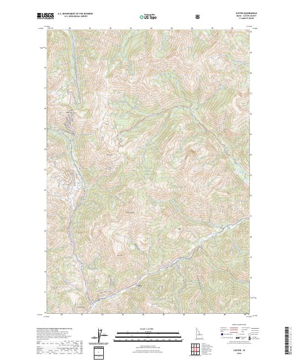
2024 Map of Custer
USGS Topo · Published 2024About this map
Custer sits at the heart of this high-elevation landscape, where the Yankee Fork Rd follows the course of the Yankee Fork through a region defined by steep mining and forestry history. The map detail highlights the intersection of natural preservation and early industrial access, with the Frank Church-River of No Return Wilderness and Challis National Forest encompassing vast stretches of the terrain. Prominent peaks like Estes Mtn and Mt Greylock tower over a network of rugged paths including the Loon Creek Road (Winter Trail) and the Lucky Boy Rd. This modern survey records the enduring layout of historic travel corridors and drainages such as Loon Creek and Jordan Creek, providing a contemporary view of the land as it remains managed for both heritage and wilderness value.
Find a feature on this map
40 named features on this map. Tap any name to fly to it.
Don’t see what you’re looking for? This feature index may not catch every label — zoom into the map to look around manually.
Map Details
Editions of this 2024 Custer Map
This is the sole edition of this map. No revisions or reprints were ever made.
Other maps of this area

1919 · Custer
USGS Topo · 1:125,000

1922 · Custer
USGS Topo · 1:125,000

1930 · Casto
USGS Topo · 1:125,000

1957 · Challis
USGS Topo · 1:250,000

1960 · Challis
USGS Topo · 1:250,000

1963 · Challis
USGS Topo · 1:250,000

1963 · Challis Creek Lakes
USGS Topo · 1:24,000

1963 · Custer
USGS Topo · 1:24,000

1963 · Casto
USGS Topo · 1:24,000
1963 · Elevenmile Creek
USGS Topo · 1:24,000