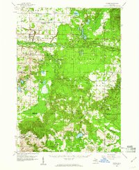
1959 Map of Custer
USGS Topo · Published 1960About this map
The Pere Marquette River and its southern branch wind through a heavily forested landscape dominated by the Manistee National Forest. This 1959 survey shows the area at a time when the Chesapeake and Ohio railroad still served the communities of Custer and Walhalla, providing a vital transit link across Mason County. The map details a dense network of rural infrastructure, including numerous country schools like Minega Sch and Kidder Sch, alongside landmark fire watch stations like the Custer Lookout Tower and Crystal Lookout Tower. To the south, Crystal Valley serves as a small hub for the surrounding township, while the northern sections are characterized by a high concentration of glacial lakes, such as Tallman Lake and Long Lake. This survey provides a meticulous record of land use, where scattered Gravel Pits and cemeteries like Riverside Cem appear amidst the growing second-growth timber of the national forest.
Find a feature on this map
87 named features on this map. Tap any name to fly to it.
Don’t see what you’re looking for? This feature index may not catch every label — zoom into the map to look around manually.
Map Details
Editions of this 1959 Custer Map
3 editions found
Other maps of this area

1931 · Custer NW
USGS Topo · 1:31,680

1931 · Baldwin NW
USGS Topo · 1:31,680

1931 · Custer SW
USGS Topo · 1:31,680

1931 · Custer NE
USGS Topo · 1:31,680

1931 · Manistee SE
USGS Topo · 1:31,680

1931 · Freesoil SW
USGS Topo · 1:31,680

1931 · Walkerville NE
USGS Topo · 1:31,680

1931 · Hart NE
USGS Topo · 1:31,680

1931 · Walkerville NW
USGS Topo · 1:31,680

1931 · Custer SE
USGS Topo · 1:31,680