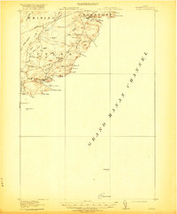
1918 Map of Cutler
USGS Topo · Published 1920About this map
Cutler sits at the edge of the Grand Manan Channel, its harbor protected by the looming elevations of Western Head and Great Head. This coastal landscape in Washington County is defined by a series of dramatic headlands and coves, where the Atlantic tide reaches into Holmes Cove and Money Cove. Further inland, the settlement pattern follows the drainage of the Moose River, where the Moose River School served the local community. The terrain is a mixture of rocky heights like Cocoa Mtn and Compass Rock, interspersed with low-lying wetlands such as Harmon Heath and Cochet Meadows. Along the western edge, the coastline breaks at Little Machias Bay, with offshore landmarks including Machias Seal I and Old Man providing critical orientation for maritime travel along this jagged Down East shore.
Find a feature on this map
47 named features on this map. Tap any name to fly to it.
Don’t see what you’re looking for? This feature index may not catch every label — zoom into the map to look around manually.
Map Details
Editions of this 1918 Cutler Map
5 editions found
Other maps of this area

1907 · Eastport
USGS Topo · 1:48,000

1908 · Eastport
USGS Topo · 1:62,500

1917 · Cutler
USGS Topo · 1:62,500

1918 · Machias
USGS Topo · 1:62,500

1918 · Cutler
USGS Topo · 1:62,500

1941 · Machias
USGS Topo · 1:62,500

1941 · Gardner Lake
USGS Topo · 1:62,500

1943 · Gardner Lake
USGS Topo · 1:62,500

1943 · Eastport
USGS Topo · 1:62,500

1945 · Eastport
USGS Topo · 1:62,500