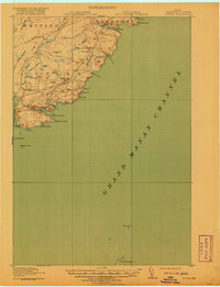
1918 Map of Cutler
USGS Topo · Published 1920About this map
Cutler stands as the primary coastal settlement on this 1917 survey of the Maine coastline, clustered where the Little River meets the sea. The landscape reflects a deeply indented shoreline of rocky points and coves, including Money Cove and Holmes Cove, alongside a terrain characterized by ridges and high points like Cocoa Mtn and Compass Rock. In the interior, the presence of School No 9 and the Moose River School suggests a rural population distributed along the inland ridges such as Pond Ridge and Great Ridge. The map captures a transition from maritime life to inland agriculture and timber, indicated by named tracts like Cochet Meadows, Warren Meadows, and Harmon Heath. This survey, conducted just before the close of the First World War, preserves the placement of isolated schools and family-named landmarks before modern infrastructure altered the coastal Washington County reach.
Find a feature on this map
49 named features on this map. Tap any name to fly to it.
Don’t see what you’re looking for? This feature index may not catch every label — zoom into the map to look around manually.
Map Details
Editions of this 1918 Cutler Map
5 editions found
Other maps of this area

1907 · Eastport
USGS Topo · 1:48,000

1908 · Eastport
USGS Topo · 1:62,500

1917 · Cutler
USGS Topo · 1:62,500

1918 · Machias
USGS Topo · 1:62,500

1918 · Cutler
USGS Topo · 1:62,500

1941 · Machias
USGS Topo · 1:62,500

1941 · Gardner Lake
USGS Topo · 1:62,500

1943 · Gardner Lake
USGS Topo · 1:62,500

1943 · Eastport
USGS Topo · 1:62,500

1945 · Eastport
USGS Topo · 1:62,500