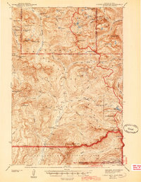
1944 Map of Cutoff Mtn
USGS Topo · Published 1944About this map
Silver Tip Ranch and the Slough Creek Guard Sta stand as isolated points of human activity within this 1942 survey of the high mountain borderlands. The landscape is dominated by the dramatic peaks of the Absaroka Range, including the prominent Cutoff Mtn and Wolverine Peak. The map highlights a remote industrial footprint at the Independence Mine near Independence Peak, illustrating the era's mining interests in the rugged Montana backcountry.
Find a feature on this map
86 named features on this map. Tap any name to fly to it.
Don’t see what you’re looking for? This feature index may not catch every label — zoom into the map to look around manually.
Map Details
Editions of this 1944 Cutoff Mtn Map
2 editions found

Other maps of this area

1886 · Canyon
USGS Topo · 1:125,000

1891 · Livingston
USGS Topo · 1:250,000

1893 · Livingston
USGS Topo · 1:250,000

1895 · Canyon
USGS Topo · 1:125,000

1896 · Canyon
USGS Topo · 1:125,000

1896 · Crandall Creek
USGS Topo · 1:125,000

1898 · Granite Mountain District
USGS Topo · 1:125,000

1899 · Crandall
USGS Topo · 1:125,000

1901 · Canyon
USGS Topo · 1:125,000

1907 · Canyon
USGS Topo · 1:125,000