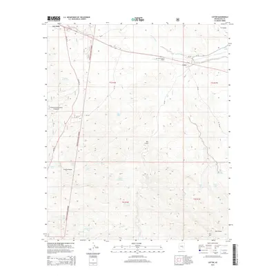
2014 Map of Cutter
USGS Topo · Published 2014About this map
Cutter serves as a central transportation hub in this Gila County landscape, where the paths of Us-70 and the San Carlos Apache Airport intersect against the rising terrain of the desert. To the northwest, the edge of East Globe marks the transition from the city toward the more open, high-relief country of the Tonto National Forest. This 2014 survey documents a complex network of water management features essential for this arid environment, including numerous named tanks like Hole in the Rock Tank, Copper Hills Tank, and Cutter Tank. The topography is defined by significant drainage systems such as Ramboz Wash and Ranch Cr, which cut through the landscape near notable peaks like Hog Mtn. Steep-walled features such as Bull Canyon and Arrastra Canyon illustrate the erosive power of seasonal flows across the different townships and ranges.
Find a feature on this map
37 named features on this map. Tap any name to fly to it.
Don’t see what you’re looking for? This feature index may not catch every label — zoom into the map to look around manually.
Map Details
Editions of this 2014 Cutter Map
This is the sole edition of this map. No revisions or reprints were ever made.
Other maps of this area

1901 · Globe
USGS Topo · 1:62,500

1902 · Globe
USGS Topo · 1:62,500

1910 · Ray
USGS Topo · 1:62,500

1915 · Christmas
USGS Topo · 1:62,500

1917 · Christmas
USGS Topo · 1:62,500

1945 · Globe
USGS Topo · 1:24,000

1954 · Mesa
USGS Topo · 1:250,000

1957 · Mesa
USGS Topo · 1:250,000

1958 · Mesa
USGS Topo · 1:250,000

1960 · Mesa
USGS Topo · 1:250,000