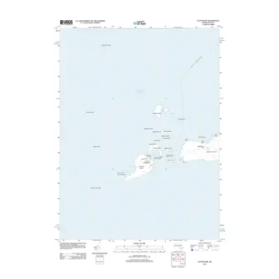
2012 Map of Cuttyhunk
USGS Topo · Published 2012About this map
Cuttyhunk Island and its neighbors in the Elizabeth Islands chain are documented in this maritime survey, revealing a landscape defined by its separation from the Massachusetts mainland. The small settlement of Cuttyhunk serves as the primary human outpost, connected to the world via the New Bedford - Cuttyhunk Ferry Crossing. This 2012 map captures the intricate coastal features of the archipelago, from the elevated peak of Saddleback Hill on Nashawena Island to the isolated Penikese Island to the north.
Find a feature on this map
36 named features on this map. Tap any name to fly to it.
Don’t see what you’re looking for? This feature index may not catch every label — zoom into the map to look around manually.
Map Details
Editions of this 2012 Cuttyhunk Map
This is the sole edition of this map. No revisions or reprints were ever made.
Other maps of this area

1885 · New Bedford
USGS Topo · 1:62,500

1885 · Sakonnet
USGS Topo · 1:62,500

1887 · Gay Head
USGS Topo · 1:62,500

1888 · New Bedford
USGS Topo · 1:62,500

1888 · Fall River
USGS Topo · 1:62,500

1888 · Sakonnet
USGS Topo · 1:62,500

1889 · Gay Head
USGS Topo · 1:62,500

1893 · Gay Head
USGS Topo · 1:62,500

1893 · Sakonnet
USGS Topo · 1:62,500

1893 · Fall River
USGS Topo · 1:62,500