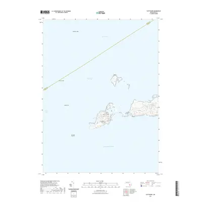
2021 Map of Cuttyhunk
USGS Topo · Published 2021About this map
Cuttyhunk Island anchors this maritime survey of the Elizabeth Islands where the Rhode Island Sound meets Buzzards Bay. The island's geography is defined by its small-scale infrastructure and coastal features, including the Cuttyhunk Cem and several local thoroughfares such as Tower Hill Rd and Gosnold Rd. The presence of Fresh Water Pond on the island contrasts with the surrounding salt water, while the nearby Canapitsit Airport serves as a critical connection point for this isolated landmass.
Find a feature on this map
21 named features on this map. Tap any name to fly to it.
Don’t see what you’re looking for? This feature index may not catch every label — zoom into the map to look around manually.
Map Details
Editions of this 2021 Cuttyhunk Map
This is the sole edition of this map. No revisions or reprints were ever made.
Other maps of this area

1885 · New Bedford
USGS Topo · 1:62,500

1885 · Sakonnet
USGS Topo · 1:62,500

1887 · Gay Head
USGS Topo · 1:62,500

1888 · New Bedford
USGS Topo · 1:62,500

1888 · Fall River
USGS Topo · 1:62,500

1888 · Sakonnet
USGS Topo · 1:62,500

1889 · Gay Head
USGS Topo · 1:62,500

1893 · Gay Head
USGS Topo · 1:62,500

1893 · Sakonnet
USGS Topo · 1:62,500

1893 · Fall River
USGS Topo · 1:62,500