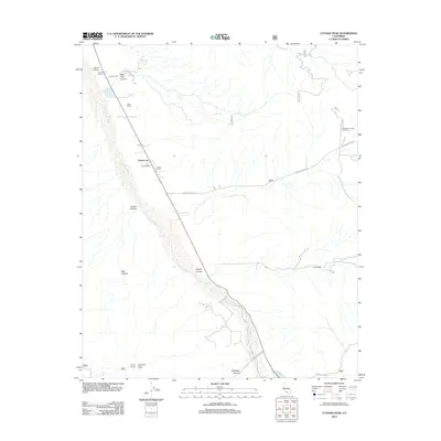
2012 Map of Cuyama Peak
USGS Topo · Published 2012About this map
The Cuyama River valley anchors this 2012 survey, revealing a landscape defined by isolated ranching outposts and high-desert terrain. The small community of Ventucopa serves as a central point along the valley floor, surrounded by a network of family-named holdings including the Monreal Ranch, Stutz Ranch, and Ogan Ranch. This settlement pattern reflects the enduring importance of water and grazing land in this part of Santa Barbara County, where the dry riverbed is flanked by deep geological features like Quatal Canyon and Deer Park Canyon.
Find a feature on this map
20 named features on this map. Tap any name to fly to it.
Don’t see what you’re looking for? This feature index may not catch every label — zoom into the map to look around manually.
Map Details
Editions of this 2012 Cuyama Peak Map
This is the sole edition of this map. No revisions or reprints were ever made.
Other maps of this area

1902 · Santa Ynez
USGS Topo · 1:125,000

1903 · Mt. Pinos
USGS Topo · 1:125,000

1905 · Santa Ynez
USGS Topo · 1:125,000

1942 · Ballinger Canyon
USGS Topo · 1:24,000

1942 · East of Cuyama Ranch
USGS Topo · 1:24,000

1943 · Rancho Nuevo Creek
USGS Topo · 1:24,000

1943 · Apache Canyon
USGS Topo · 1:24,000

1943 · Santiago Creek
USGS Topo · 1:24,000
1943 · Ballinger Canyon
USGS Topo · 1:24,000

1943 · Cuyama Peak
USGS Topo · 1:24,000