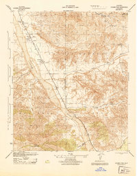
1944 Map of Cuyama Peak
USGS Topo · Published 1944About this map
The Cuyama Valley opens into a broad alluvial corridor in the mid-1940s, providing a vital agricultural and transport link through the northern reaches of the Los Padres National Forest. At this time, the Cuyama River system dictates the settlement pattern, with numerous family-run operations such as Monreal Ranch, Stutz Ranch, and Wycoff Ranch scattered along the valley floor. The small community of Ventucopa serves as a local hub near the Santa Barbara Ventura line, while the presence of the Cuyama Ranger Sta and the Cuyama Lookout atop Cuyama Peak reflects the active federal management of the surrounding timber and rangeland.
Find a feature on this map
25 named features on this map. Tap any name to fly to it.
Don’t see what you’re looking for? This feature index may not catch every label — zoom into the map to look around manually.
Map Details
Editions of this 1944 Cuyama Peak Map
This is the sole edition of this map. No revisions or reprints were ever made.
Other maps of this area

1902 · Santa Ynez
USGS Topo · 1:125,000

1903 · Mt. Pinos
USGS Topo · 1:125,000

1905 · Santa Ynez
USGS Topo · 1:125,000

1942 · Ballinger Canyon
USGS Topo · 1:24,000

1942 · East of Cuyama Ranch
USGS Topo · 1:24,000

1943 · Rancho Nuevo Creek
USGS Topo · 1:24,000

1943 · Apache Canyon
USGS Topo · 1:24,000

1943 · Santiago Creek
USGS Topo · 1:24,000
1943 · Ballinger Canyon
USGS Topo · 1:24,000

1943 · Cuyama Peak
USGS Topo · 1:24,000