
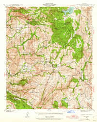
1942 Map of Cuyamaca Peak
USGS Topo · Published 1954About this map
The Viejas Indian Reservation and Inaja Ind Res occupy significant portions of this Southern California landscape, which was surveyed just as the United States entered the second World War. Much of the northeast is dedicated to Cuyamaca Rancho State Park, anchored by the high peaks of Cuyamaca Pk and Stonewall Pk above the Cuyamaca Reservoir. The map documents a network of interior truck trails, such as the Boulder Creek Truck Trail and King Creek Truck Trail, which provided essential access for fire suppression and resource management in these highlands.
Find a feature on this map
71 named features on this map. Tap any name to fly to it.
Don’t see what you’re looking for? This feature index may not catch every label — zoom into the map to look around manually.
Map Details
Editions of this 1942 Cuyamaca Peak Map
2 editions found
Other maps of this area

1893 · El Cajon
USGS Topo · 1:62,500

1901 · Elcajon
USGS Topo · 1:62,500

1903 · Cuyamaca
USGS Topo · 1:125,000

1903 · Elcajon
USGS Topo · 1:62,500

1903 · Ramona
USGS Topo · 1:125,000

1904 · Southern California Sheet No. 2
USGS Topo · 1:250,000

1931 · Vallecito
USGS Topo · 1:125,000

1931 · Carrizo
USGS Topo · 1:125,000

1939 · El Cajon
USGS Topo · 1:62,500

1939 · Campo
USGS Topo · 1:62,500