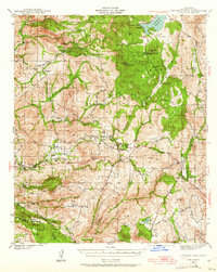
1942 Map of Cuyamaca Peak
USGS Topo · Published 1961About this map
Cuyamaca Rancho State Park dominates the northeast quadrant of this landscape, characterized by high peaks and strategic lookout points surveyed just before the mid-century. The map captures a transition from the mountainous wilderness of Cuyamaca Pk and Stonewall Pk to the valley settlements and ranchlands that supported the region's early growth. Notable tribal lands including the Viejas Indian Reservation and Capitan Grande Indian Reservation occupy significant portions of the western terrain, with the Viejas Valley serving as a central corridor for travel. Settlement patterns are concentrated along arterial routes like the road through Descanso and Guatay, where clusters of buildings signify community hubs such as The Willows and Hulburd Grove. The presence of Anahuac Sch and Japatul Sch highlights the distribution of rural educational centers for the scattered ranching families of Rancho Alegria and Lyster Ranch during this era of San Diego County history.
Find a feature on this map
66 named features on this map. Tap any name to fly to it.
Don’t see what you’re looking for? This feature index may not catch every label — zoom into the map to look around manually.
Map Details
Editions of this 1942 Cuyamaca Peak Map
2 editions found

Other maps of this area

1893 · El Cajon
USGS Topo · 1:62,500

1901 · Elcajon
USGS Topo · 1:62,500

1903 · Cuyamaca
USGS Topo · 1:125,000

1903 · Elcajon
USGS Topo · 1:62,500

1903 · Ramona
USGS Topo · 1:125,000

1904 · Southern California Sheet No. 2
USGS Topo · 1:250,000

1931 · Vallecito
USGS Topo · 1:125,000

1931 · Carrizo
USGS Topo · 1:125,000

1939 · El Cajon
USGS Topo · 1:62,500

1939 · Campo
USGS Topo · 1:62,500