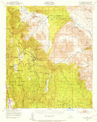
1942 Map of Cuyapaipe
USGS Topo · Published 1956About this map
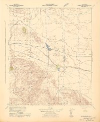
The Overland Stage Route traces a historic path through the high desert and mountain gaps of eastern San Diego County, passing through the Vallecito area and north of the Vallecito Range. This 1942 survey, based on 1939 aerial photography, documents a landscape transitioning between remote ranching outposts and early recreation. Scattered settlements and family-named landmarks like Campbell Ranch, Morris Ranch, and Thing Ranch dot the valleys, while the Sunrise Highway climbs into the Laguna Mountains to reach Laguna Camp and Shriners Lodge.
Find a feature on this map
66 named features on this map. Tap any name to fly to it.
Don’t see what you’re looking for? This feature index may not catch every label — zoom into the map to look around manually.
Map Details
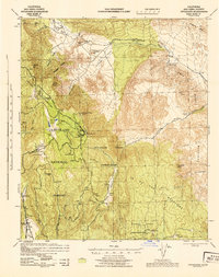
Editions of this 1942 Cuyapaipe Map
3 editions found

Other maps of this area

1903 · Cuyamaca
USGS Topo · 1:125,000

1903 · Ramona
USGS Topo · 1:125,000

1904 · Southern California Sheet No. 2
USGS Topo · 1:250,000

1931 · Vallecito
USGS Topo · 1:125,000

1931 · Carrizo
USGS Topo · 1:125,000
1939 · Campo
USGS Topo · 1:62,500

1939 · Santa Ysabel
USGS Topo · 1:62,500

1939 · Borrego
USGS Topo · 1:62,500
1939 · Jacumba
USGS Topo · 1:62,500
1942 · Barrel Spring
USGS Topo · 1:62,500