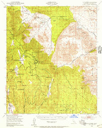
1942 Map of Cuyapaipe
USGS Topo · Published 1958About this map
Cuyapaipe Indian Reservation and the Manzanita Indian Reservation dominate this high-altitude landscape in San Diego County, where the transition from the Laguna Mountains to the desert floor is marked by steep canyons and historical travel corridors. The map records the path of the Overland Stage Route and Butterfield Stage Route through Vallecito Creek, tracing a legacy of early California transit. Deep within the Cleveland National Forest, recreation and residence are evidenced by several clusters including Laguna Camp, Shriners Lodge, and the distinctively named Coca Cola Lodge. The presence of the Sundown Tungsten Mine and numerous family ranches like Thing Ranch and Flinn Ranch highlights a mid-century economy of small-scale extraction and remote homesteading. At Aqua Caliente Hot Springs, the landscape begins its descent into the arid reaches of the Vallecito Mtns.
Find a feature on this map
53 named features on this map. Tap any name to fly to it.
Don’t see what you’re looking for? This feature index may not catch every label — zoom into the map to look around manually.
Map Details
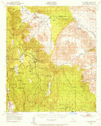
Editions of this 1942 Cuyapaipe Map
3 editions found

Other maps of this area

1903 · Cuyamaca
USGS Topo · 1:125,000

1903 · Ramona
USGS Topo · 1:125,000

1904 · Southern California Sheet No. 2
USGS Topo · 1:250,000

1931 · Vallecito
USGS Topo · 1:125,000

1931 · Carrizo
USGS Topo · 1:125,000

1939 · Campo
USGS Topo · 1:62,500

1939 · Santa Ysabel
USGS Topo · 1:62,500

1939 · Borrego
USGS Topo · 1:62,500

1939 · Jacumba
USGS Topo · 1:62,500

1942 · Barrel Spring
USGS Topo · 1:62,500