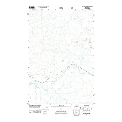
2011 Map of Cyclone Creek
USGS Topo · Published 2011About this map
The White River and Clearwater River converge in this high-altitude landscape of King County, defining a complex drainage system fed by numerous mountain tributaries. The terrain is dominated by the massive presence of Grass Mountain to the east, which rises above a series of high-elevation water bodies including Beaverdam Lake, Lynn Lake, and the curiously named Stink Lake. This 2011 survey documents a primarily undeveloped area where human infrastructure is limited to Route 410 and a network of forest roads. The map reveals the intricate headwaters of Charley Creek and Boise Creek in the north, while the southern half is characterized by the deep valleys of Canyon Creek and Old Pond Creek. This hydrological network illustrates the transition from high alpine ridges to the river basins that eventually serve the Puget Sound region.
Find a feature on this map
15 named features on this map. Tap any name to fly to it.
Don’t see what you’re looking for? This feature index may not catch every label — zoom into the map to look around manually.
Map Details
Editions of this 2011 Cyclone Creek Map
This is the sole edition of this map. No revisions or reprints were ever made.
Other maps of this area

1913 · Cedar Lake
USGS Topo · 1:125,000

1953 · Eagle Gorge
USGS Topo · 1:24,000

1953 · Cumberland
USGS Topo · 1:24,000

1956 · Greenwater
USGS Topo · 1:62,500

1956 · Enumclaw
USGS Topo · 1:62,500
1956 · Enumclaw
USGS Topo · 1:24,000

1957 · Wenatchee
USGS Topo · 1:250,000

1960 · Bandera
USGS Topo · 1:62,500

1975 · Snoqualmie Pass
USGS Topo · 1:100,000
1986 · Bearhead Mtn
USGS Topo · 1:24,000