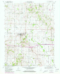
1961 Map of Cynthiana
USGS Topo · Published 1981About this map
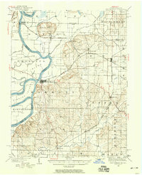
The town of Cynthiana sits at the intersection of early transportation routes in Southwest Indiana, where the Louisville and Nashville line and local roads like Cedar Grove Road meet. This survey shows the agricultural character of the landscape, interspersed with family-named landmarks such as Benson Cem and Knowles Cem that provide valuable data for local genealogists. The influence of early industry is visible in the scattered Oil Wells across the northern townships and a Coal Mine located near the Gibson and Posey county borders.
Find a feature on this map
51 named features on this map. Tap any name to fly to it.
Don’t see what you’re looking for? This feature index may not catch every label — zoom into the map to look around manually.
Map Details
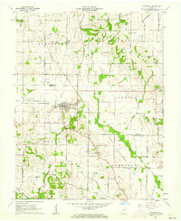
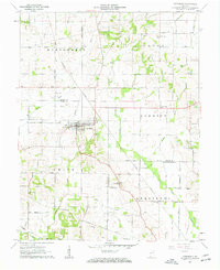
Editions of this 1961 Cynthiana Map
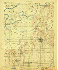
Other maps of this area

1901 · Princeton
USGS Topo · 1:62,500

1901 · Haubstadt
USGS Topo · 1:62,500

1903 · Haubstadt
USGS Topo · 1:62,500

1903 · New Harmony
USGS Topo · 1:62,500
1903 · Princeton
USGS Topo · 1:62,500

1903 · Patoka
USGS Topo · 1:125,000

1904 · Mount Carmel
USGS Topo · 1:62,500
1938 · New Harmony
USGS Topo · 1:62,500

1956 · Vincennes
USGS Topo · 1:250,000

1957 · Vincennes
USGS Topo · 1:250,000